Projects and Research
This is a listing of some of our recent project and research activity. It includes collaborative efforts between students, faculty, and staff as well as ongoing applied efforts with outside agencies. It is not comprehensive, and may not include unpublished work or smaller projects.
Data Security of UAS in Public Safety Operations
Dates: 2023 - Current
Faculty, Staff and Students: Merrick (Principal), Broder (Principal)
In the past few years, there has been a significant increase in concern about the use of foreign-manufactured small UAS by government entities and/or public safety throughout the United States. The existing climate of concern about these drones centers on aircraft and systems that are manufactured in China and that may pose a significant cyber security risk to U.S. infrastructure.
The specific threats to government agencies are not clear (or available to the public) but the central theme revolves around unauthorized data being sent to China or other locations. This may be concerning to some users - or it may be no issue at all. The risk depends entirely on the use case of the UAS in question. For example, a UAS used on or near critical infrastructure may pose a threat if telemetry or imagery is sent to an unauthorized location, while a data release from UAS used for primary flight training at a non-secure location would pose limited or no threat to the operator's organization or the nation.
In 2023, Florida Administrative Rule 60GG-2.0075 went into effect as required under Florida Statute 934.50. This rule prohibits the use by government entities of aircraft manufactured in a 'country of concern' (which includes China). This rule has resulted in the majority of Florida agencies to retire their fleets of DJI aircraft and replace them with American-made ships and equipment. FAR 60GG-2.0075 also permits universities to conduct research on aircraft that otherwise are not permitted for use in Florida.
EMHS has launched this ongoing research program to evaluate a variety of aircraft - including those manufactured in China - on what information is being transmitted to where, from either the aircraft itself or the controller. Since the all aircraft included in this study only have WiFi connection capability, the foundation of this research will be to capture all traffic transmitted via TCP/IP and evaluate that traffic's destination as well as the purpose of the transmission.
To accomplish this, all participant aircraft in the study are connected to a known, controlled WiFi router. All traffic on that router is captured using commercial and/or open source TCP/IP packet capture software. Packet capture logs will be analyzed for origin, destination, and purpose, and the analysis and raw data will be posted on this website for use by other researchers or interested parties.
Disaster Intelligence Analysis Laboratory (DIAL)
Dates: 2022 - Current
Faculty, Staff and Students: Merrick (Principal), McDaniel (Principal), Broder (Principal), Reid, Perna, Tuffigo, Hart
Student analysts in DIAL utilise Open-Source Intelligence (OSINT) techniques to gather intelligence and produce reports that can be used by stakeholders for decision making purposes. Operating on FSU’s campus in the Bellamy building, the DIAL lab is set up to function as a fusion center with live monitoring of social media networks and other sources of OSINT. This combination of academic research and working with public safety officials offers students exclusive practical experience in the intelligence field. Students wo are interested in interning or working in DIAL should apply at the EMHS Internships Page.
Disaster Incident Research Team (DIRT)
Dates: 2012 - Current
Faculty, Staff and Students: Merrick (Principal), McDaniel, Broder, Casserleigh, Cuadra, Duggleby (B.), Dilling, Hart
This ongoing program provides a framework and policy for conducting a variety of applied research activities in the field. DIRT research may include data gathering in disasters for academic research projects as well as applied work in the areas of unmanned systems, urban search and rescue, and business recovery.

FSU Virtual Operations Support Team (FSU.VOST)
Dates: 2012 - Current
Faculty, Staff and Students: Merrick (Principal), Broder, Hart, Cuadra, Duggleby (B.)
EMHS operates a Virtual Operations Support Team (VOST) that supports the State of Florida's State Emergency Response Team (SERT) during activations for disasters and critical incidents. VOST provides information support and situational awareness by utilizing student volunteers to mine social media during incidents. This information helps SERT understand what is happening with the public and improves decision making. FSU.VOST is a unique opportunity open to interested students from EMHS and other disciplines. More information is available at http://fsuvost.org.
Applied Emergency Management Studio - Belize City, Belize
Dates: 2018
Faculty, Staff and Students: Cuadra (Principal), Broder, Hart, Duggleby (B.), Bardoul, Fohr, Levanti, Quintero, Rose, Weingold.
During the week of June 20-27th, 2018, ten members of Florida State University’s Emergency Management and Homeland Security Department (EMHS) traveled to Belize City, Belize to work with the Belize Association of Planners (BAP). Together these two groups worked to collect data on resident perceptions of climate change and natural disaster risk in two local communities: Jane Usher and Between Canals. This project was initiated to gather baseline data on communities that typically see negative impacts from severe weather events and climate change. Information was collected through surveys, which largely asked residents objectively what they had observed in their own community over the last five years.
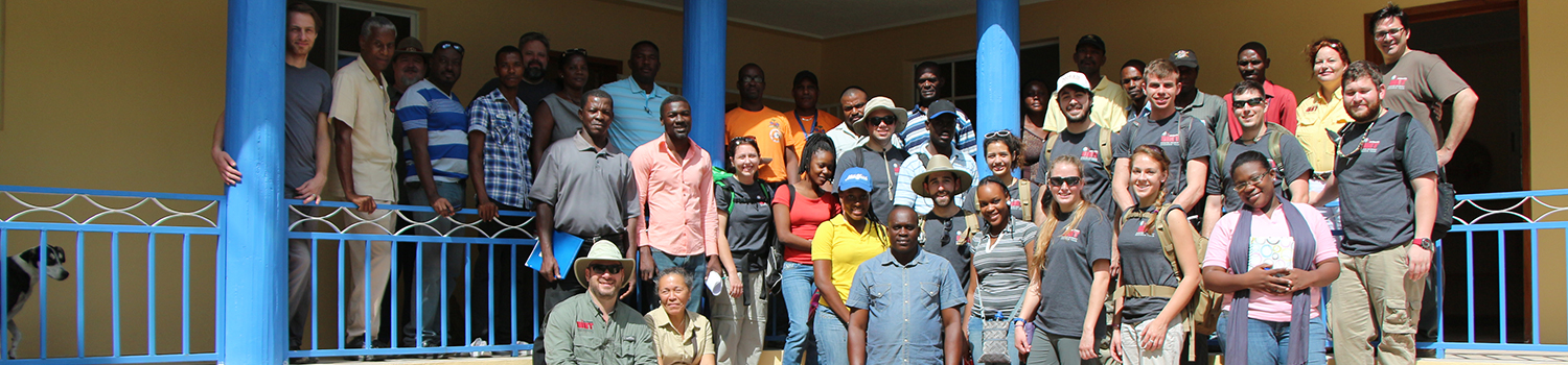
Research Cooperation with PADF Haiti
Dates: 2017
Faculty, Staff and Students: Merrick (Principal), Broder, Cuardra, McDaniel (M.)
Research cooperation and data collection along open drainage systems using UAS. Partnership with United States Agency for International Development - Pan American Development Foundation, Port Au Prince and Cap Haitien.
George C. Marshall Center Collaboration
Dates: 2016
Faculty, Staff and Students: Duggleby (R.) (Principal), Casserleigh, Bell
[Coming soon]
Disaster Management Training Development - Rosseau, Dominica
Dates: Summer 2016
Faculty, Staff and Students: Casserleigh (Principal), Merrick, Broder
EMHS faculty members worked closely with the Florida Association of Volunteers Active in the Caribbean and Americas (FAVACA) to conduct training sessions with local emergency managers on the island of Dominica. Trainings were designed specifically for Community Emergency Response Team (CERT) leaders with sustainability in mind so that these leaders could then train future CERT members.
Applied Emergency Management Studio - Tierra Amarilla, Atacama Desert, Chile
Dates: Summer 2016
Faculty, Staff and Students: McDaniel (Principal), Cuadra, Duggleby (B.), Kinch, Barrios, Berges, Escobar, Rojas
Faculty, staff, and four students from the EMHS Program partnered with Candelaria Mining Company in Tierra Amarilla, Chile and the University of Chile in Santiago. Over the course of 5 days, students led trainings in disaster preparedness and, in particular, training community members on a communication plan designed specifically for the Tierra Amarilla community. Students designed the plan themselves and ultimately found their project to be a great success with project partners and participants. Community members stated that they felt better equipped to communicate with friends and family regarding the dangerous hazards and effects of natural disasters.
EMHS became initially involved in this project in the aftermath of an extreme flooding event in the Atacama Desert in March 2015. Although it is the driest place on earth, severe rains caused uncharacteristic conditions in the region, leading to the flooding of several populated areas. Tierra Amarilla, a town of about 11,000 residents, was impacted by this disaster, and many survivors lost loved ones, their homes, and possessions. In a disaster of this magnitude, it is often difficult to communicate with those affected. FSU EMHS faculty and staff advised students on the development of the communication plan for Tierra Amarilla, bearing in mind the physical and technological constraints of communication in the region.
Applied Emergency Management Studio - Meghauli, Chitwan District, Nepal
Dates: Spring 2016
Faculty, Staff and Students:Duggleby (B.), Bell, Merrick, Broder, Casserleigh, Houston, Smith, Ransdell, Williams, Wiman
For its Spring 2016 project, the EMHS Program partnered with the prominent Nepalese non-profit organization, Clinic Nepal, to lead trainings and discussions in topics ranging from CPR/First Aid, disaster preparedness, sanitation and hygiene, and swift water safety techniques. Over the course of 7 days and 10 training sessions, five EMHS students trained nearly 250 community leaders, schoolteachers, and students.
The project was a collaborative effort between students FSU, social work students from Tribhuvan University in Kathmandu, Nepal, and medical students from Ludwig-Maximillians University College of Medicine in Munich, Germany. While students from FSU brought expertise relevant to aspects of emergency management and healthcare, the Nepalese students were able to speak to the importance of mental health following a disaster. The German students were also essential to assisting with CPR/First Aid training. As a whole, the project brought together programs from all over the world to work toward a shared goal: a more disaster-resistant Nepal.
Applied Emergency Management Studio - San Mateo, Ambergris Caye, Belize
Dates: Summer 2015
Faculty, Staff and Students: Casserleigh (Principal), McDaniel, Merrick, Broder, Duggleby (B.), Shannon, Crozier, Gallagher, Hart, Kinch, Lemarque, Rogers
The Disaster Incident Research Team (DIRT), consisting of faculty, staff, and six student researchers, conducted field research in San Mateo, gathering information on demographics and resources within the community. The team partnered with the Belize Red Cross, whose members provided vital insight and knowledge about San Mateo and the greater island community.
The project was divided into two parts:
- Teams of EMHS staff and student researchers surveyed San Mateo community members to gather data on the community’s vulnerabilities to disaster. Community members were asked primarily about infrastructure, utilities, and bills and taxes paid to the local government.
- Members of EMHS faculty and staff, comprising the UAS flight operations team, flew several missions throughout San Mateo. Employing the use of small Unmanned Aerial Systems (sUAS), the team took photos and recorded video of the community so as to construct orthographic photos and gain a better understanding of the physical aspects of San Mateo.
Informal Settlers and Disasters
Dates: 2011 - 2015
Faculty, Staff and Students: Dilling (Principal), Samples, Cuadra, Brower, Merrick, Culkin
More than a billion people live in marginal and informal settlements, many without access to basic services, and very frequently in high-risk areas. Their vulnerability to disaster events is often compounded by a lack of infrastructure, environmental degradation, and increasing challenges exacerbated by climate change and sea level rise. If there is so much technology for prediction and prevention, why do governments/donors continue to struggle with losses in the same communities, disaster after disaster? Evidence in the scientific community leads us to believe the answer to this question lies in the process of how human settlements are established and the underlying factors that encourage the population within those communities to establish in high risk areas.
Publications Include
Cuadra, J and Dilling, J. “Relocation of Disaster-prone Informal Settlements: Development Opportunity or Perpetuation of Poverty?” ACSP 2015, USA
Cuadra, J, Dilling, J, Brower, R and Samples, M. “Current Relocation Practices Targeting Disaster Prone Communities in Developing Countries: Case Study San Francisco Libre, Nicaragua”. TIEMS Japan 2014. Published: Journal of Disaster Research Vol.10No.2: Special Issue 2015
Dilling, J, Brower, R, Cuadra, J, and Samples, M. “Informal Settlers, Government Officials, and Disaster Vulnerability: Experience from the Philippines” ICCEM 2014 Portugal. Keynote Presentation. Published: Journal of Safety and Crisis Management Vol 4 2014
Brower. Ralph S., Dilling, Janet, Magno, Francisco, A, Evolving and Implementing a New Disaster Management Paradigm: The Case of the Philippines, Book Chapter in Disasters and Development (Kapucu and Liou, eds). 2013
Applied Emergency Management Studio - Ile a Vache, Haiti
Dates: Spring 2014
Faculty, Staff and Students: Merrick (Principal), McDaniel, Casserleigh, Broder, Danley, Dubosar, Duggleby (B.), Ewbank, Ford, Hurtado, Johnson, Makowski, Mutnansky, Resnick
EMHS Program’s first international student research project was comprised of four objectives:
- Update potable water source information on Île-à-Vache – Some data exists on water sources on the island. Building on that data, the EMHS team conducted site surveys of all identifiable and accessible water sources and tested for accessibility, quality, and salinity, with the focus of identifying water sources that are most likely to be viable after a disaster.
- Develop a methodology to review public structures to include shelters and critical facilities and mission essential functions (MEF) equipment – Construction techniques and location indicate that many private residences on the island will not withstand a significant storm. There is also not sufficient transportation to evacuate those at risk off the island. Therefore, it is critical to identify locations on the island in which residents can take refuge.
- Develop a comprehensive hazard map of the island – New elevation data and maps were required to produce a hazard map. Small Unmanned Aerial Systems (sUAS) were utilized to capture high resolution aerial photos of the island, from which terrain models and orthographic photos could be constructed.
- Develop community outreach material outlining the data collected and planning accomplished – Teams worked to develop materials targeted at specific audiences, with simplified, easy-to-understand material available for communities, local government, and planners.