

EMHS, CDRP and DIRT UAS
In 2012, several EMHS faculty began looking at how small unmanned aircraft systems could be applied to emergency and disaster management. At that time, the aircraft themselves were relatively simple, and many of our first aircraft were assembled by our team.
Over the next few years, EMHS expanded our role and capabilities. The first UAS classes at FSU were taught in 2015, and in 2017, FSU EMHS was included in the State Air Operations Standard Operating Guide. We operate a professional training program for UAS operators and program managers, and we have deployed UAS and remote sensing professionals to over 26 major disasters and full-scale exercises.
Our UAS activities are part of DIRT - the Disaster Incident Research Team - which was created in 2011 to bring researchers to active disasters and incidents.
Research

EMHS conducts a variety of research and applied projects involving UAS, remote sensing, GIS, and data integration.
Operations
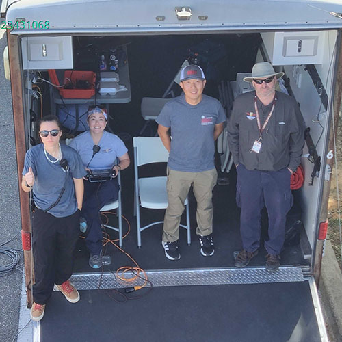
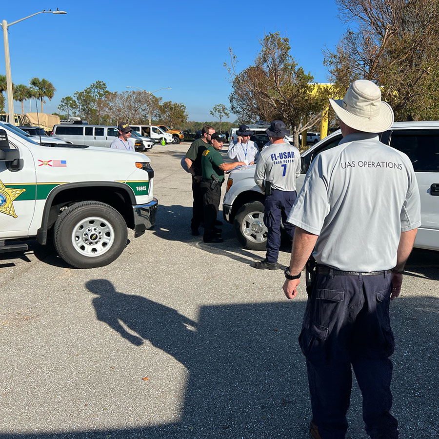
Our UAS team is a State of Florida deployable resource, and has responded to a variety of disasters and incidents.
Training
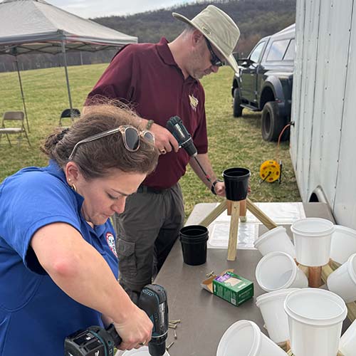
UAS training is a core competency of the EMHS UAS team, and we have trained dozens of local, state, and Federal agencies and operators.
UAS and Remote Sensing Team


UAS and Remote Sensing Research
As pracademics, we strive to combine research and field applications in everything that we do. In the field of UAS, we have led the nation on the application and integration of UAS into emergency and disaster management - and that knowledge and experience is translated back into the FSU classroom.
FSU EMHS has had four National Science Foundation (NSF) funded projects since 2017, each focused on different aspects of data acquisition and application. These projects brought advances to how UAS data is utilized in disasters, and laid a foundation for ongoing research at other institutions.
Currently, FSU EMHS is part of the NSF AI Institute for Societal Decision Making. This project aims to apply innovative artificial intelligence systems into emergency managers, thus improving decision-making and outcomes.
Current Research Projects
AI Institute for Societal Decision Making (NSF 2229881) - The four-year project applies novel and existing artificial intelligence to a variety of societal issues. FSU EMHS is a partner, focused on enabling the intersection of AI research and applied emergency management and remote sensing applications. FSU principal investigators, faculty, staff, and graduate students provide critical real-world insight into disaster decision making, data applications, and situational awareness.
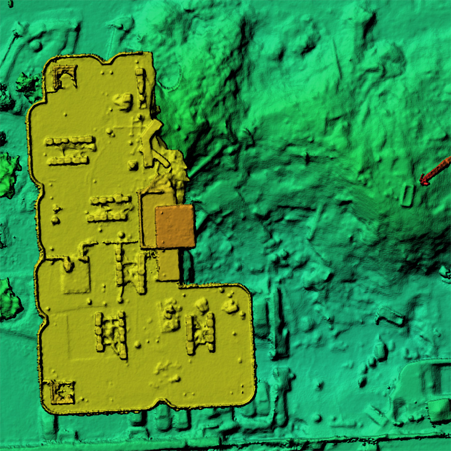
Applications of LiDAR in Search and Public Safety - LiDAR sensors deployed on small UAS are already used in surveying, mining, and construction. EMHS UAS deployed LiDAR after Hurricane Milton in support of seawall and beach assessments, demonstrating the basic capabilities of this complex sensor. This project examines the utility of these sensors in applications such as missing persons searches, criminal investigations, and other public safety contexts.
Disaster Remote Sensing Applications - Disaster remote sensing, geospatial intelligence, and disaster intelligence all exist to better inform decision makers. This project combines several disciplines to advance the collection, processing, analysis, and distribution of remote sensing products.
Notable Past Research Projects
Data Collection for Robot-Oriented Disaster Site Modeling at Champlain Towers South Collapse (National Science Foundation 2140573) - This project analyzed digital surface models and orthomosaic imagery over 19 days and created models for detecting survivable voids in a collapsed structure. Based on the EMHS UAS team's 25-day deployment to Surfside for the State of Florida, we utilized almost 2TB of imagery and products to build a layered model of the collapse.
Machine Learning for Dehazing Unmanned Aerial System Imagery from Volcanic Eruptions (National Science Foundation 1840878) - Disaster imagery is often collected in less-than-ideal environmental conditions. This project applied dehazing techniques to imagery collected during the Lower Puna Volcanic Event on the island of Hawaii in 2018. The methods developed during this work advanced the techniques used in future disaster scenarios.
Unmanned Aerial System Datasets from Hurricanes Harvey and Irma (National Science Foundation 1762139) - In 2017, after Hurricane Harvey, the Center for Robot Assisted Search and Rescue, part of the Texas A&M College of Engineering, collaborated with several partners including FSU EMHS to deploy the largest collection of UAS and operators to date. This deployment covered several Texas counties and spanned ten days. This project collected, organized, and annotated the largest dataset of UAS imagery to that point for the use of outside researchers.
UAS and Remote Sensing Operations
In the past decade, EMHS has responded to over 26 major disasters and incidents throughout Florida, as well as Texas, Hawaii, and Louisiana. This wealth of experience translates to everything we do - from developing new techniques on the application of LiDAR in public safety, to training new operators, to teaching academic classes at FSU.
Our team helped the State of Florida's Division of Emergency Management develop one of the most robust UAS integrations in the country. We became a part of the State's Air Operations Branch in 2016 and developed the first contingency airspace management plan in the nation that included small UAS as well as traditional manned response aircraft. In 2016, FSU's EMHS UAS team deployed as part of the Florida Urban Search and Rescue system (ESF-9) in response to Hurricane Matthew, laying the groundwork for how UAS integrates to a variety of response missions.
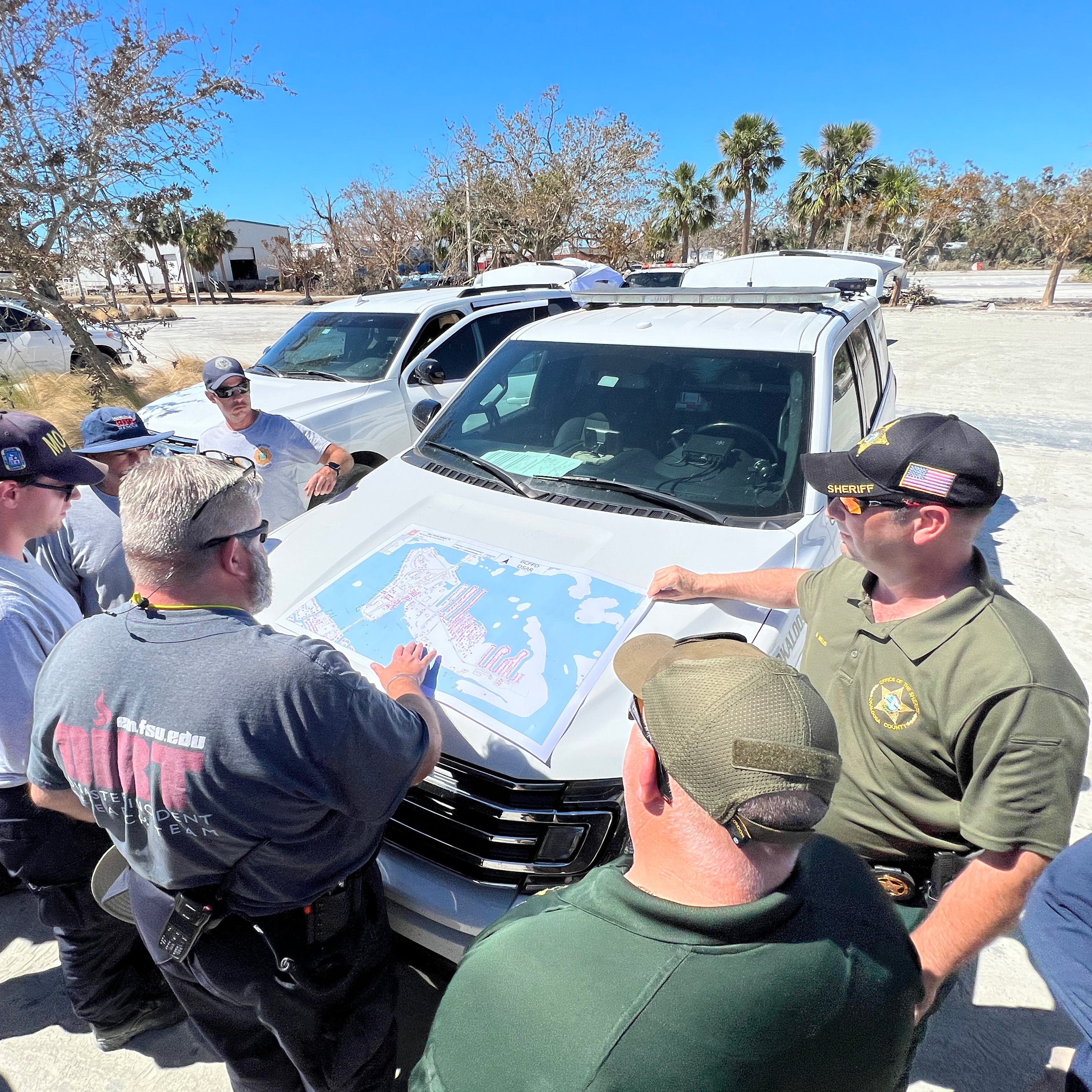
In 2021, the team deployed for 25 days to Surfside, Florida in response to the Champlain Towers South condominium collapse. Working with state and Federal US&R teams, FSU EMHS developed the standard for how remote sensing and UAS imagery integrates with US&R search management technology.
In addition to state activations, the EMHS UAS Team has supported dozens of local and regional events, including missing persons, supporting law enforcement on cold cases and criminal investigations, disaster mitigation projects, wildfires, and flooding. We understand how to integrate UAS and remote sensing into the needs of the incident commander. We have experience working with tactical teams, K9s, and manned aviation resources.
FSU EMHS has supported FSU Police, Emergency Management, and Athletics since 2018. Headed to a home football game? You'll see our UAS and crews there monitoring traffic and external stadium locations for the entire day. We respond to calls for service on medical emergencies, security issues, and missing persons - all conducted by our team of professionals and students.
Significant Activations and Deployments
Haiti Disaster Mitigation Project (2013, 2014), Belize Mitigation Project (2015), Hurriance Hermine (2016), Hurricane Matthew (2016), Hurriance Harvey (2017), Hurriance Irma (2017), Hurriance Michael (2018), Lower Puna Volcanic Eruption (2018), Hurricane Dorian (2019), Hurriance Sally (2020), Musset Bayou Waildfire (2020), Champlain Towers South Collapse (2021), Hurricane Ida (2021), Hurriance Ian (2022), Hurriance Idalia (2023), Hurricane Debby (2024), Hurriance Helene (2024), Hurriance Milton (2024).
Disaster and incident response is a team effort - and we are proud of what we can do to support other response and recovery experts. If your organization needs support in a current or future incident, let us know.
UAS and Remote Sensing Training
"Flying is the easy part." This is something that all our students hear, no matter what specific course or class we are teaching. We focus on this point as a way to remind students that the point of flying a UAS during a disaster or incident isn't to get pretty pictures... it is to enable better and faster decision making. This means that UAS pilots and crews need to be proficient in operating their systems, but also understand how to get data and information that decision makers in the command post or emergency operations center need.
Our training follows this philosophy. Yes, we teach basic and advanced flight maneuvers, mapping, reconnaissance, search, and night operations. We also teach that all of this is secondary to the information provided. In 2018, our team worked over twelve hours, in hazardous conditions, accumulating almost seven hours of flight... to ultimately deliver a post-it note to the command post. That was what was needed - critical information on lava flow speed and direction - not 50GB of photos and video (though we got that too!).
UAS Training Courses
If a student is starting from scratch, we recommend UAS Response Technician first, then UAS Response Specialist. Introduction to Public Safety UAS Operations is a good starting point as well, and overlaps with the first day of UAS Response Technician. Disaster Mapping can be taken at any time.
Available course information is listed below. Custom courses are available upon request.
Pricing listed is per student, in Tallahassee. Arrangements can be made to deliver the course at the client's location, but pricing will vaary due to instructor travel costs. Volume discounts are available.
Course List (Click to Expand)
UAS Response Operations (UASRO) - 24 Hours
UAS Response Operations
Duration: 24 Contact Hours
Delivery Method: Classroom and Hands-On Flights
Base Price: Pricing update in progress - contact us for details
The UAS Response Operations class is a 24-hour curriculum taught over three days, including nighttime operations. At the end of the curriculum, students will be prepared to deploy and operate a small UAS in a variety of public safety contexts, including law enforcement operations, fire fighting, hazardous materials, reconnaissance, basic mapping, damage assessment, and search and rescue.
Students will participate in classroom lecture and discussion, then take lessons to the field and apply them using small UAS. Instructors emphasize safety and risk management throughout the course.
This course does not involve instruction on basic flight operations. Students are expected to have basic proficiency with the operation, maintenance, and support of small UAS. Students should bring a multirotor UAS to the course.
The training curriculum and materials were developed by the professionals at the FSU Center for Disaster Risk Policy, the Texas A&M Humanitarian Robotics and Artificial Intelligence Laboratory (HRAIL), and the Center for Robot-Assisted Search and Rescue (CRASAR). This team has decades of applied experience in unmanned systems, robotics, computer engineering, emergency management, and disaster response.
Student learning objectives include:
- Recognize all Federal regulations regarding operation of UAS in the National Airspace System, including 14 CFR Part 107, 14 CFR Part 91, 14 CFR Part 61, and Section 333 and Section 336 of Public Law 112-95
- Recognize all state statutes and regulations regarding the operation of UAS in public safety.
- Identify the components and purpose of the Incident Command System as well as the Air Operations Branch at the incident and SLTT levels.
- Analyze issues with and risks to UAS operations created by conditions such as crew capability, terrain, weather, obstructions, manned aviation, and airspace classification.
- Evaluate all conditions for a UAS flight and make an appropriate "go/no-go" decision.
- Perform safe and effective UAS operations as part of a designated UAS crew, including appropriate risk analysis and management.
- Identify appropriate locations and conditions to conduct UAS operations based on launch/recovery needs, airspace and regulatory factors, obstructions, terrain, and weather.
- Plan a UAS sortie to accomplish a specific set of mission parameters given available resources.
- Determine appropriate UAS airframes, payloads, and communication systems based on mission requirements and conditions such as weather, traffic density, and terrain.
- Determine an effective communications plan to include two-way communication as well as monitoring for situational awareness.
- Describe procedures for obtaining emergency authorization to fly in controlled airspace or other FAA-restricted locations.
- Formulate plans for multiple unmanned aircraft and crews to operate simultaneously over or near an incident scene.
- Apply techniques to effectively operate a UAS in the following public safety mission types: damage assessment, route clearance, search and rescue, firefighting, law enforcement support, and surveillance/reconnaissance.
- Apply techniques to effectively operate and apply UAS in nighttime conditions.
Schedule of Topics
- Day 1
- Safety, Responsibility, and Human Factors
- Crew Resource Management
- ICS, UAS, and Aviation Integration
- Flight Operations 1 - Introduction and Sensor Employment
- The Operating Environment
- Emergency Authorizations and the SOSC
- Domain Awareness and Airspace Management
- Flight Operations 2 - Emergency Procedures
- Flight Operations 3 - Close Approach and Multi-Aircraft Operations
- Day 2
- Mission Planning for Public Safety Operations
- Mission and Data Management I
- Flight Operations 4 - Scavenger Hunt
- Flight Operations 5 - Overwatch and Search Operations
- Flight Operations 6 - Dynamic Targets
- Payload Considerations / Thermal Sensors
- Risk Awareness at Night
- Flight Operations 8 - Night Operations
- Day 3
- Incident Management
- Flight Operations 7 - Automation Systems
- Flight Operations 9 - Search and Reconnaissance
- Flight Operations 10 - Mapping
- Flight Operations 11 - Interior Ops
- Practical Assessment
Find a UAS Response Operations Course
UAS Data Technician (UASDT) - 16 Hours
UAS Data Technician
Duration: 16 Contact Hours
Delivery Method: Classroom and Incident Simulation
Base Price: Pricing update in progress - contact us for details
The UAS Data Technician class is a 16 hour continuation of the UAS Response Operations course. At the end of the curriculum, students will be prepared to utilize data collected by sUAS (multi-rotor and fixed-wing) to create and integrate a variety of products for the Operations and Planning sections of a major incident, as well as manage the collection, analysis, and distribution of data, imagery, and products.
This course is heavy on classroom lecture and includes hands on experience with photogrammetry software, GIS platforms, and specialized analysis tools. The course concludes with a simulated incident, requiring students to apply the techniques, tools, and procedures included in the course material.
Flight operations are limited in this course, as it focuses on planning, data management, and data processing. Flight operations can be integrated into the course on request.
The training curriculum and materials were developed by the professionals at the FSU Center for Disaster Risk Policy, the Texas A&M Humanitarian Robotics and Artificial Intelligence Laboratory (HRAIL), and the Center for Robot-Assisted Search and Rescue (CRASAR). This team has decades of applied experience in unmanned systems, robotics, computer engineering, emergency management, and disaster response.
Student learning objectives include:
- Understand and develop a remote sensing collection plan, utilizing all available resources.
- Perform quality control and assessment of data collected by sUAS in the field.
- Apply techniques and software to create georectified orthomosaic imagery.
- Determine appropriate sensors and systems to collect data, then integrate the collected data to meet incident objectives.
- Plan multiple sUAS sorties to accomplish the objectives of a remote sensing collection plan.
- Create an airspace management plan to deconflict manned and unmanned resources on an incident.
- Create primary, alternate, contingency, and emergency communications plans for coordinating sUAS teams, aircraft, and data on an incident.
Schedule of Topics
- Day 1
- Collection Planning
- Quality Control
- Mission and Data Management II
- Collection Exercise - sUAS Mapping
- Orthomosaic Processing - Online
- Orthomosaic Processing - Offline
- Day 2
- Data Communications
- GIS Integration with ESRI
- Imagery Analysis Tools
- Product Development and Distribution
- Practical Assessment and Exercise
Find a UAS Data Technician Course
UAS Response Technician (UASRT) - 40 Hours
UAS Response Technician
Duration: 40 Contact Hours
Delivery Method: Classroom and Hands-On Scenario Based Flights
Base Price: Pricing update in progress - contact us for details
UAS Response Technician is a five day combination of UASRO and UASDT. The order of topic presentation may differ, but the same material and objectives are covered.
In particular, the Practical Assessment is a different format, combining both flight operations and product creation and delivery.
Find a UAS Response Technician Course
Introduction to Public Safety UAS Operations - 16 hours
Intro to Public Safety UAS Operations
Duration: 16 Contact Hours
Delivery Method: Classroom and Hands-On Scenario Based Flights
Base Price: $500 per student (in Tallahassee)
The Introduction to Public Safety UAS Operations class is a beginner-level class intended for new UAS operators expected to operate under 14 CFR Part 107 or Public Aircraft Certificates of Operation (COA). This two-day course reinforces the material required to pass the Part 107 Remote Pilot certificate and includes hands-on operation of small UAS in a public safety context.
Student learning objectives include:
- Recognize all Federal regulations regarding operation of UAS in the National Airspace System, including 14 CFR Part 107, 14 CFR Part 91, 14 CFR Part 61, and Section 333 and Section 336 of Public Law 112-95
- Recognize all state statutes and regulations regarding the operation of UAS in public safety.
- Identify the components and purpose of the Incident Command System as well as the Air Operations Branch at the incident and State levels.
- Determine personal minimums in regard to risk, including drug and alcohol effects, weather, and mission requirements, utilizing a PAVE checklist.
- Analyze issues with and risks to UAS operations created by conditions such as terrain, weather, obstructions, manned aviation, and airspace classification.
- Evaluate all conditions for a UAS flight and make an appropriate "go/no-go" decision.
- Distinguish the need for jurisdictional and organizational policies regarding the operation of unmanned systems for public safety and emergency management.
- Identify appropriate locations and conditions to conduct UAS operations based on launch/recovery needs, airspace and regulatory factors, obstructions, terrain, and weather.
- Plan a UAS sortie to accomplish a specific set of mission parameters given available resources.
- Perform safe and effective UAS operations as part of a designated UAS crew.
- Apply techniques to effectively operate a UAS in a variety of public safety mission types.
- Perform safe and effective UAS operations as part of a designated UAS crew.
Find an Intro Course
Training Calendar
EMHS schedules courses in advance at our Tallahassee training locations.